To a 5-year-old, a standard flat world map looks like a confusing swirl of arbitrary pastel shapes and tiny country borders. Rote memorization of capital cities and political lines often drains the joy out of geography. How can we make Earth's geography tangible, memorable, and full of living wonder?
The Montessori Method: The Tactile Puzzle Map
In traditional Montessori classrooms, children learn geography using the iconic wooden Puzzle Map of the World. Each continent is an individual, touchable piece with a knob. The child uses three fingers to lift Africa, feel its curved silhouette, and slide it into place on the blue globe.
This physical engagement builds muscle memory and spatial relationship awareness:
- Children notice how South America looks like it could nestle right into the side of Africa.
- They realize how vast the Pacific Ocean truly is compared to the landmasses.
- They connect polar ice caps to extreme latitude rather than just cold weather.
Connecting Geography to Animals & Habitats
Abstract landmasses become unforgettable when children discover who lives there. Instead of teaching "Australia" in isolation, link it directly to marsupial wonders: the hopping red kangaroo, the sleepy koala chewing eucalyptus, and the Great Barrier Reef fringing the coastline.
3 Key Biomes to Explore with Your Child
1. The African Savanna (Grasslands & Predators)
Wide golden plains dotted with acacia trees. Children explore the delicate relationship between towering herbivores (elephants and giraffes) and stealthy predators (lions and cheetahs) gathering around life-saving water holes.
2. The Antarctic Polar Ice (Survival in the Cold)
Children discover how emperor penguins huddle together against -40° winds and how thick blubber protects orcas swimming through freezing polar oceans.
3. Tropical Coral Reefs (Underwater Cities)
Coral reefs cover less than 1% of the ocean floor, yet they harbor 25% of all marine life. Children learn that corals are living animal colonies, building colorful homes for anemone-dwelling clownfish and gentle sea turtles.
How Little Discoveries Transforms Geography
In our Earth & Nature chapter, we bring geography and wildlife to life through calm, interactive exploration:
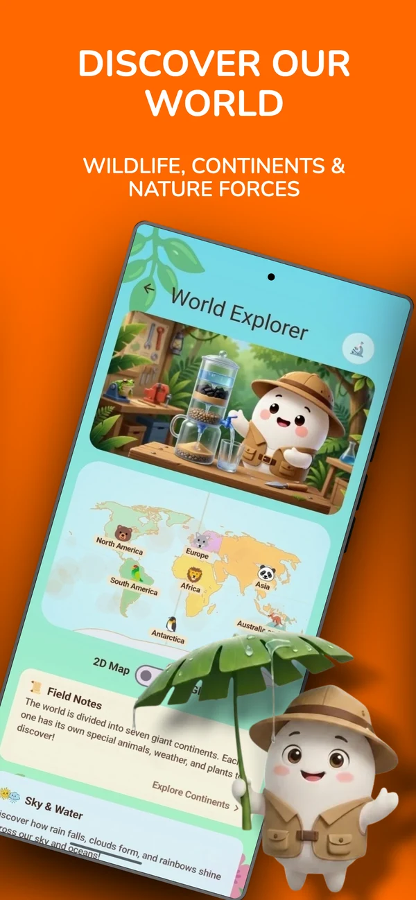
- Interactive 3D World Globe & 2D Map: Children spin a real-time 3D globe or explore a flat map of all 7 continents, tapping each landmass to dive into its native ecosystems.
- Safari Snapshot & Wildlife Games: Kids photograph African savanna animals, shelter Antarctic penguin families, and explore habitats with gentle audio cues and cheerful chirps.
- Coral Reef Architect Mini-Game: Kids tap to plant living branching, brain, and fan corals, watching the reef bloom with rising bubble streams while clownfish, yellow tangs, and jellyfish swim between them.
- Multilingual Pronunciation: Hear continent and animal names naturally spoken in English, Italian, and Lithuanian to nurture early vocabulary.
Place blue towels on the living room rug to represent oceans. Cut cardboard shapes for the 7 continents and spread them out. Have your child "fly" a toy airplane between continents, delivering toy animals to their correct native habitats!
Open the World Map for Your Little Explorer
Explore the 7 continents, safari animals, and coral reefs on Google Play and Apple App Store.